Integrating a map of the prevalence of asbestos in houses across Australian neighbourhoods into Commonwealth Government databases to help planning for asbestos removal and to ensure community safety in response to natural disasters.
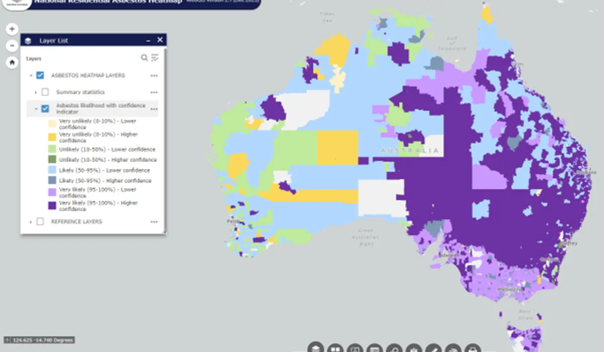
ASSEA has created the National Residential Heatmap (the Heatmap) to provide Government Agencies and other stakeholders with an interactive visualisation of the likelihood of asbestos (or asbestos containing material) in residential structures across Australia.
The Heatmap brings together a range of datasets on residential buildings in Australia, to estimate the probability of asbestos containing materials (ACMs) in the community. The Heatmap is hosted on the Digital Atlas of Australia (DAA) for Government, supported by Geoscience Australia, which allows for the integration of a range of geospatial datasets for planning for asbestos removal, and to ensure first responder, and community safety in response to natural disaster events.
The Heatmap can be accessed by all levels of government. To request an access to the Digital Atlas of Australia for Government, please visit https://digital.atlas.gov.au/pages/access.